After some drama, the logistics worked out and I took the one-way hiker bus to Glacier Point and then the aptly named Panorama Trail back to the valley.

The park claims it is 8.5 miles but my GPS said I did 9.7. Not my fastest hike as it took 5 hours. That is 2 miles per hour, but the camera was getting well over 80 photos per mile (ppm?) until the steep descents. Here are a few pics for now, I will post more photos later on the other site. Camera lessons learned from this hike are: don’t need the telephoto in the Sierras (guessed that and did not bring it), granite in the sunlight with a dark blue sky and green trees is more contrast than even a great camera can handle – no wonder Ansel ran photography classes here, I may have to buy some app to help adjust the pics. Also, if you only have one lens and a few settings, spend the 5 minutes to check them before you go to a place like this. Huge opportunities missed once again – d’oh
I will backdate a hiking log later, but that will be for me. The annotated pic below tells you what you need to know. I did not know this was a life list hike, but now that I have done it, it is.


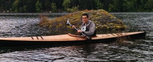
The last pic (SafeTrail) is supposed to be sarcastic. Most of the descent did not have handrails.
WOW!!!!
The panorama is awesome and clear.
So very, very wow!
This is the first time i have seen a photo that shows why they probably call it half dome!
The photos are stunning, and it ors look like a life list trail. This would take my hubby 15 hours. I think he does more like 250 shots per mile. 🙂